End of US highway 78 |
 |
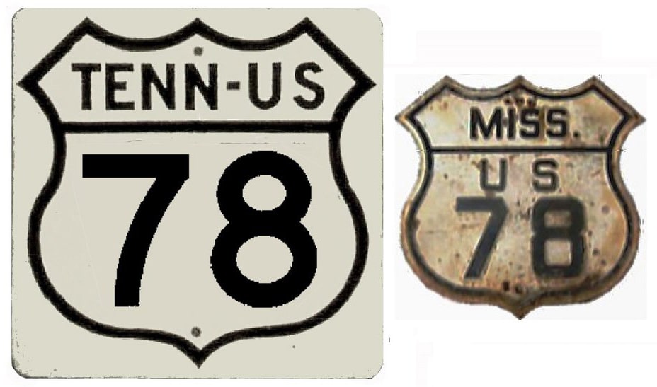
Summa
|
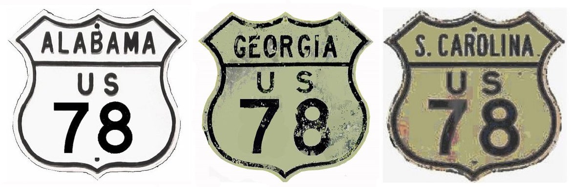
Summa
|
|
Mileage: in 1989 AASHTO listed a figure of 727 miles for US 78... however, that included the mileage of US 78's associated business routes. According to the state subtotals on AASHTO's 1989 spreadsheet, mainline US 78's actual end-to-end total at the time was 715 miles. That is reasonably close to our own 2020 measurement, which yielded 700.8 miles (reroutings and realignments likely explain the difference). But at the time US 78 still ended in Memphis; the route has since been truncated into Arkansas. Our 2023 measurement yielded 845.1 miles.
|
|
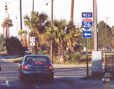
US 78 was an original 1926 route. Nearly a century after its creation, its west end was extended to an interchange near the town of Cash, Arkansas. US 78 now terminates at its junction with US 67 (future I-57); it remains to be seen when ARDoT will signpost the route accordingly.
Until 2023, the west end of US 78 was in Memphis. Modern TNDoT maps indicated the terminus was still on Linden Avenue at 2nd Street, which was essentially the same endpoint shown on this 1940 map, except at the time 3rd Street was used for both northbound and southbound traffic (rather than the 2nd/3rd one-way couplet used today):
Until 2023, the west end of US 78 was in Memphis. Modern TNDoT maps indicated the terminus was still on Linden Avenue at 2nd Street, which was essentially the same endpoint shown on this 1940 map, except at the time 3rd Street was used for both northbound and southbound traffic (rather than the 2nd/3rd one-way couplet used today):
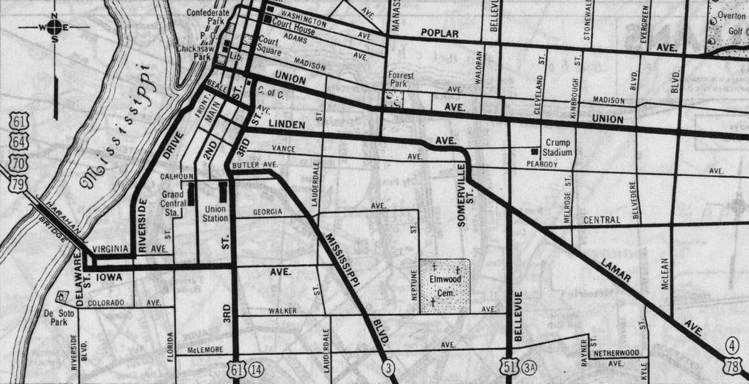
c. 1940, Rand McNally
|
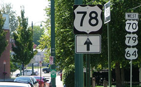
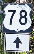
This photo was taken looking south on 2nd. The intention here may have been for the US 78 marker to have a left arrow (not a straight-ahead arrow), because that route began to the left on Linden, which is visible in the distance:
|
Sanderson, Oct. 2007
|
|
If a driver was alert enough to make that left turn on Linden, they would have seen the first confirming marker about four blocks to the east:
|
Sanderson, Oct. 2007
|
|
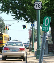
That was at the Turley Street intersection; Danny Thomas is a block ahead. (On the far side of Danny Thomas was the first US 78 assembly that included an "East" tab.) Note also in the foreground the zero mile-marker for TN 278 (it is doubtful that the route's beginning is exactly there; more likely it begins at the same place US 78 did).
Heading the opposite direction (west on US 78), the route was not signed all the way to its terminus. This photo was looking west on Crump Boulevard: |
Sanderson, Oct. 2007
|
|
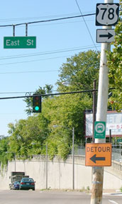
US 78 traffic was directed to the north on East Street, but that was the last mention of the route. After three or four blocks, US 78 turned west again on Linden, but there was no signage for that turn, nor was there any US 78 signage at all before reaching its endpoint. This photo was looking west on Linden at 2nd, where the US 78 designation officially ended:
|
Sanderson, Oct. 2007
|
|
The east end of US 78 has always been in Charleston. Traffic winds up on King Street, but signage is very poor. One of the few US 78 signs anywhere near the terminus was shown here:
|
Karners, Apr. 2014 (but removed by Dec. of that year)
|
|
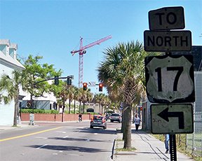
Romney Street has an exit from northbound I-26. At the end of the offramp, US 78 was directed to the west on Romney, and then the sign above was posted where Romney intersects King. US 78 continues about 14 blocks south from there, passes under the US 17 viaducts, and ends at Line Street (which carried US 17 traffic before modern US 17 was built). This photo was looking south on King:
|
Karners, Apr. 2014 (unchanged since at least 2006)
|
Since King has no direct access to US 17, traffic is directed to the left on Line, then left again on Meeting Street (which is US 52, and is equally unsigned). US 78 officially ends at Line, and sometime after May 2013, a new "End" assembly was posted:
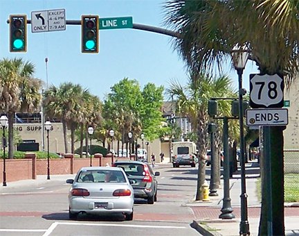
Karners, Apr. 2014
|
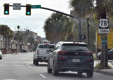
Nasiatka, Feb. 2022
|
|
Historically, US 78 continued a block or two past Line, ending at Columbus or Spring during different times (photos and more info on the Charleston page, which includes historic maps of the city).
Heading the opposite direction (north on King), US 78 begins here at Line (the US 17 overpasses are visible in the distance)... |
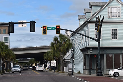
Nasiatka, Feb. 2022
|
|
...however, drivers do not see US 78 reassurance signage until they have driven for about a mile-and-a-half:
|
Dawson, Sep. 2001
|
Karners, Apr. 2014
Those were looking north on King at Mt. Pleasant Street; cars behind the I-26 assembly are on US 52 (Meeting).
|
Research and/or photo credits: Justin Cozart; David Dawson; Karin and Martin Karner; J.P. Nasiatka; Alex Nitzman; Dale Sanderson; Michael Summa
Page originally created 2002;
last updated Dec. 5, 2023.
last updated Dec. 5, 2023.